Source : The EurAsian Times
A look at the globe or the World map shows the Indian subcontinent as a small entity embedded by colossal water bodies in the East, West, and South and pressed by a vast land mass in the North.
China says ‘Indian Ocean is not India’s Ocean’; Is it time to ‘Heavily Militarize’ Andaman and Nicobar Islands & thwart PLA’s evil design ?
Coincidentally, almost all projections used for drawing World maps were invented by Europeans. There is, perhaps, not a single projection created by an Indian. This has always intrigued me why Indian intelligence never considered drawing the World map. I could be wrong in my assumption.
Sometimes I wonder why persons of eminence like Mercator never realized that the projection he invented showed 3.2 million square kilometers of the Indian subcontinent at least four to five times smaller than Alaska when he knew that facts were otherwise.
Merely passing it off as an aberration due to their relative global location does not appear convincing. Was it then a deliberate attempt to show the Indian subcontinent as something inconspicuous and insignificant?
The answer may never be known. In two-dimensional projection, the size of the subcontinent shrinks even more.
A closer look at the map would reveal a different picture. Our obsession with the Northwest is so overpowering even today that whenever an Indian talks about an external threat to Indian security, one invariably starts with Pakistan.
Nothing could be further from the truth. Recorded history reveals that although many invaders came from the Northwest, they were plunderers. Only the Mughals entrenched their feet firmly. But all those who came from the South via the sea route became rulers. Be it the Dutch, French, or British.
Every Indian, including policymakers, suffers from a disease, which I term as Northwest Centricity. The trauma of partition, three full-fledged wars with Pakistan, and of course, the Chinese invasion of 1962 have only acted as the cementing adhesive on the psyche of every Indian alive that they refuse to look elsewhere.
Unfortunately, the military is no exception, except perhaps the Indian Navy. But their way of looking South is more comical than strategic. To make an extremely valid point that India should look southwards, the map of India is invariably projected with the peninsula projecting upwards during presentations by the navy.
I hope my naval friends do not take my observation as anything but in a lighter vein.
Indian apathy towards the South and East needs no elaboration. The eastern region lies East of the chicken neck, i.e., the Siliguri corridor. A few facts listed below shall exemplify the points:
- Land forces deployed in the East are relatively lesser equipped. The eastern army was called the ‘Forgotten Army’ by my army friends in the Higher Command course, and they were not joking.
- Three of the four strike corps of the Indian Army are western border oriented, perhaps more due to terrain than strategic military considerations.
- The IAF deploys her most modern resources decidedly West of around 85 degrees East. We could have played havoc with the Chinese if we chose to use the then-existing IAF resources in 1962. This fact is being stated because the IAF aircraft would have operated in an environment of total air supremacy. We, perhaps, are the only country that chose not to use existing military resources when attacked by a neighboring country.
- Myanmar took over Little Coco Island. We learned about it only after a bulletin was issued. Myanmar has now allowed the Chinese to set up a listening post and a radar station barely 65 km North of Andamans.
- There is hardly any radar or air defense cover in the East or South, particularly island territories.
- We still do not have a fighter wing based in the island territory, the strategic importance of which needs no emphasis.
- Our lack of concern towards our island territories has resulted in various claims by other nations, e.g., New Moore Island by Bangladesh, Nicobar Island by Indonesia, and Narcondam Island by Myanmar.
Regional Geography
The Indian Ocean is the third largest among the oceans behind the Pacific and Atlantic and is the only ocean named after a country. Southward jutting of the Indian peninsula gives the Indian Ocean a characteristic “M” shape.
Some of the world’s most strategic waterways connect the Indian Ocean with the rest of the World in the East, West, and South. These waterways are:
- Malacca, Sunda, and Lombok Strait in the East.
- Straits of Hormuz and Bab el Mandeb in the West.
- Cape of Good Hope in the South.
The geography is far from favorable to India as a nation. Andaman and Nicobar Islands stretch for nearly 680 kilometers from North to South and are almost 1,300 kilometers away from the Indian mainland. The island territories are closer to Indonesia and Thailand. Little Coco Island, now an alien territory, is only 45 kilometers from Landfall Island.
Over 70% of the world’s oil trade passes through the Indian Ocean. This figure will likely go up in the foreseeable future if it has not risen. Briefly, the Indian Ocean Region (IOR) can be represented statistically in the following manner:
- Area 73.4 million Square Kilometers
- Population 2 billion (1/3rd of the World)
- Water Area 1/5th of the World
- Cargo Movement – 35% of bulk cargo
- 54% of container cargo
- 70% of oil cargo
The ocean is surrounded by land on three sides and links the Atlantic and Pacific oceans and, most importantly, provides economical routes for shipping.
The three most important parameters that drive the world economy are abundant in the IOR, strategic minerals in southern Africa, oil in the Middle East, and cheap labor in ASEAN countries and neighborhoods. Let us now look at the presence of the military in the IOR:
Military Deployment In The IOR
If we look at the map and move northwards from the southern tip of IOR, the following facts emerge:
- France controls the Reunion, Mayotte, and Tromelin Island chains.
- Diego Garcia is one of the largest military bases operated by the UK/USA. In addition, Chagos Island is controlled by the UK.
- Australians occupy Cocos Island.
- US and Russian Navy warships patrol the waters in the IOR regularly.
- US forces in the Gulf are at a stone’s throw from IOR.
To say that US forces dominate IOR would be an understatement. The figures given below speak for themselves:
- The US was granted a 50-year lease of Diego Garcia by the UK, which expired in 2016. But the lease was extended by the UK for another 20 years.
- As of date, the US has two Carrier Battle Groups and three Amphibious Task Forces (ATFs) with nearly 100 warships manned by approximately 40,000 personnel.
- Diego Garcia has 12,000 feet long runway fit for the heaviest aircraft existing.
- Anchorage facilities for carrier-size warships exist.
- At least 250 US aircraft are deployed.
China factor too has to be taken into account. China has assisted Myanmar and established naval bases at Kyaukphu, Munaung, and Haing Gyi. Similar assistance to Thailand has resulted in Mergui and Zadaikyi Katan Islands emerging as naval bases.
The issue is not their present size. The problem is their existence from where the soft underbelly of the Indian subcontinent can be endangered.
Limitations: Andaman & Nicobar Islands
A considerable distance from the Indian mainland is and will always remain a significant drawback regarding security issues for the Andaman and Nicobar Islands. It is this peculiar nature that demands an entirely different overview. Briefly, the limitations can be stated to be:
- Dependence on the Indian mainland for every need.
- Inadequate protection renders the island territories prone to subversion.
- Piracy.
Indian Options
Facts listed above lead us to the following options:
- Maintain status-quo.
- Upgrade infrastructure.
- Provide incentives to people from the mainland to settle in Andaman & Nicobar Islands.
- Increase military presence
If ever there was a need to be proactive concerning future security needs, it is now. Let us utilize the island territories for what is most suitable. That is to project power in the IOR. We need to learn the tenets of national security from the US and China.

These two nations have repeatedly proved to the World that they shall, always and every time, take actions that are in their best national interests, global opinion notwithstanding. China currently has two main preoccupations.
First, to develop its economy, which is already on a trot. The Chinese leadership wants it to gall up. Second, its interests in Taiwan. China shall not rest until it has annexed Taiwan, US intervention notwithstanding.
There shall be no third time that US forces shall move out of the US mainland in such large numbers as may be required to prevent a direct Chinese invasion of Taiwan. The experience of Vietnam and Iraq has made every American sit up and notice that the Americans are dying on foreign soil, fighting not necessarily in the best US interests.
In the foreseeable future, no US president will likely influence the US senate and, more importantly, the US public, which shall permit large-scale US troops deployed to fight elsewhere, Europe inclusive.
China is merely waiting for that time. Once Taiwan is behind them, the entire Chinese attention shall shift to IOR.
We still have the time and scenario suited to the Indian requirement of militarizing the Andaman and Nicobar Islands. We have everything for such action, provided we can remove the mindset in our decision-makers, be it political, bureaucratic, or military.
A quantum increase in the Indian military shall send the right signals to the world. Work on other options may continue alongside.
Conclusion
We should shift our focus to the South and East rather than only remaining Pakistan and China-centric looking Northwest. Let us not ignore an innocuous statement by a Chinese defense official – “The Indian Ocean is not India’s ocean.”
Let there be no ambiguity that the China of tomorrow is not headed eastwards to the West coast of the US. It is decidedly headed westwards to IOR through Malacca Straits. The future of the World economy lies with the seas. We are fortunate to have it in abundance.
Let us not forfeit it to others almost entirely due to voluntary negligence of our island territories over the last five decades. We have the military capability and assets. The desire and determination to employ these are lacking. Let us not hide behind lame excuses for not doing enough, even though a far more notorious factor has emerged as a Tsunami.
Many will hide behind this natural enemy and suggest that basing valuable military assets that may be wiped out in one wave would be foolhardy. Yes, indeed, it would, as it has already happened. But national security, always and every time, takes precedence over the loss of material assets, however expensive these may be.
Recommendations
- Move and locate at least one division worth of the army, suitably equipped with amphibious capability and integral air elements.
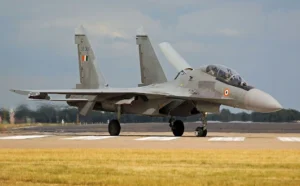
- Move two twin-engine strike fighter squadrons permanently. At a later date, Su-30 with air-to-air refueling elements should move to Port Blair and Car Nicobar.
- IAF should examine the possibility of enhancing the radar cover on the Andaman and Nicobar Islands.
- Coast Guards should be equipped with small but agile, fast-moving boats that should be armed to check piracy and illegal immigration.
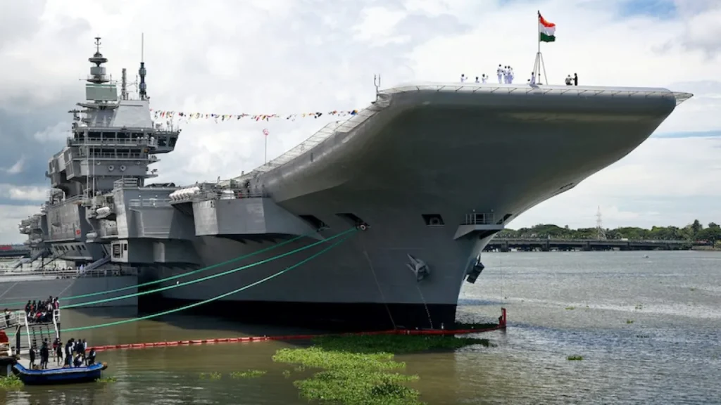
- Indian Navy should consider acquiring one more carrier, exclusively deployed in the IOR near or close to the Andaman and Nicobar Islands.


